
The "Forest Trail" is part of the European long-distance hiking route E11 in the Baltic States, passing through the most beautiful forests and national parks of Latvia, Lithuania and Estonia. The route begins on the Polish-Lithuanian border in the town of Lazdijai, continues in Latvia through Riga and reaches Tallinn in Estonia.
Name in Latvia: Mežtaka
Name in Lithuanian: Forest trail
Name in Estonia: Metsa matkarada
Length: ~2,141 km, 102-114 days
- In Lithuania - 747 km, 36-38 days
- In Latvia - 674 km, 31-38 days
- Estonia - 720 km, 35-38 days
The route is divided into sections of ~20 km, indicating accommodation and transport providers.
Road surface: forest roads and trails, gravel roads, roadsides of paved roads, sandy or rocky beaches.
Forest trail section Lazdijai-Veisiejai: https://baltictrails.eu/lt/forest/day/127
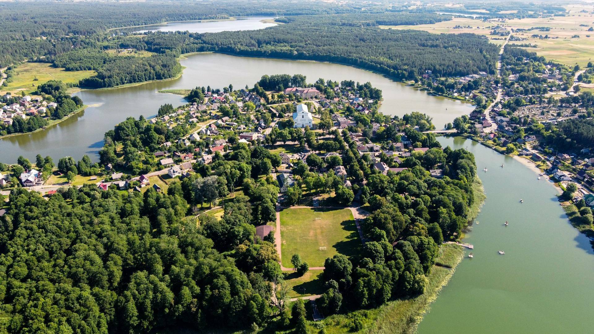
In the Lazdijai district, the “Forest Trail” begins a little more than 1 km from the Lazdijai Tourism Information Center branch, located on the Lithuanian-Polish border. The forest trail winds along the Lazdijai–Augustavas road (No. 135), then turns onto a small village-forest road, which served as a border protection road during the “Iron Curtain”. In this section, beautiful and wide views of the cultivated land of the Sūduva Upland open up in places. After crossing a more open area in front of the village of Kučiūnai, the Forest Trail dives into the forested surroundings again. After approximately 5.5 km, the route turns east, continues winding through a labyrinth of forests and lakes, crosses the Zapsė River and meets the Lazdijai–Kučiūnai–Veisiejai road (No. 2510). After less than 6 km, the route turns right, to the village of Dainaviškės. After circling the bays of Lake Veisiejai, the Forest Trail leads through the Veisiejai Manor Park to the city center. The section to the city of Veisiejai leads through the territory of the Veisiejai Regional Park.
Veisiejai-Trikojis section of the forest trail: https://baltictrails.eu/lt/forest/day/128
Leaving the center of Veisiejai town, the Forest Trail crosses the channel of Lake Veisiejai, then along Vytautas, Turgaus and Leipalingis (road No. 134) streets leads to the shore of Lake Snaigynas, where you can find an observation tower and recreation areas. After crossing a small forest near Veisiejai, the Forest Trail leads for about 1.4 km along the Veisiejai–Barčiai (road No. 2529), then turns right. The route then winds through a beautiful pine forest next to Lake Ančia, the surroundings of which are rich in berries and mushrooms. Turning east, the Forest Trail approaches the village of Barčiai from the south. It continues to Lake Trikoji through cereal fields. Near the bay of Lake Trikoji, the Forest Trail crosses forested areas, getting closer to road No. 2517. This section of the Forest Trail winds through the Veisiejai Regional Park.
Forest trail section Trikojis-didžiasalis: https://baltictrails.eu/lt/forest/day/129
From Lake Trikoji and the village of Bertašiūnai, the Forest Trail runs south along road No. 2517, crosses the Leipalingis–Kapčiamiestis road (No. 2505) and the village of Viktarins. The trail then goes around Lake Stirta and meanders along forest paths through wide forest massifs, where meadows and small villages can be seen in places. In summer, the forest is rich in blueberries and mushrooms. The forest trail crosses the stream connecting Lakes Baltajis Bils and Juodajis Bils, climbs the steep shore of the lake and turns south. At this point, you can see the village of Didžiasalis. The section from Lake Trikojis to the village of Viktarins runs in the territory of the Veisiejai Regional Park.
Information from the website https://baltictrails.eu/lt/forest
Public Institution Lazdijai Tourism Information Center
Kauno St. 6A, LT-67128 Lazdijai
www.lazdijai-turizmas.lt
Email: [email protected]
Phone: +370 318 51881


Reviews