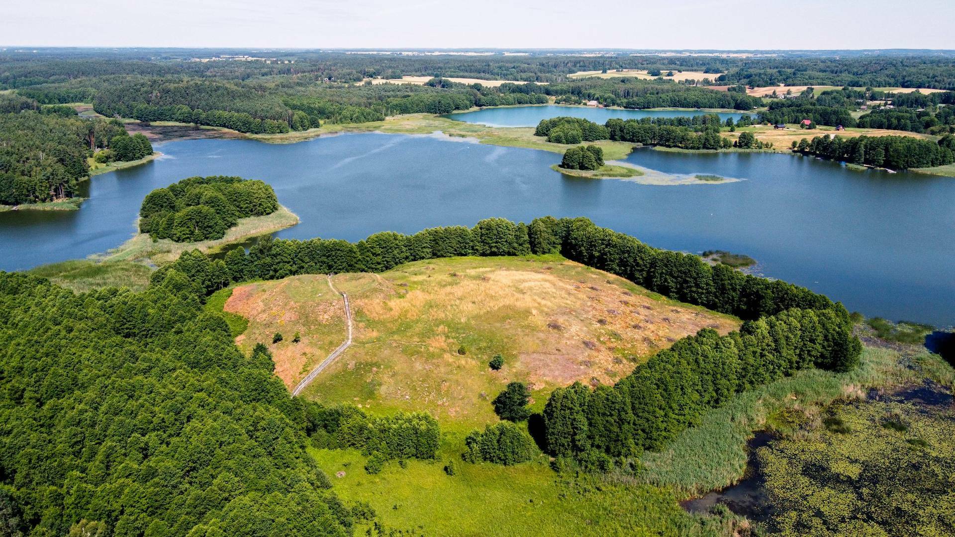
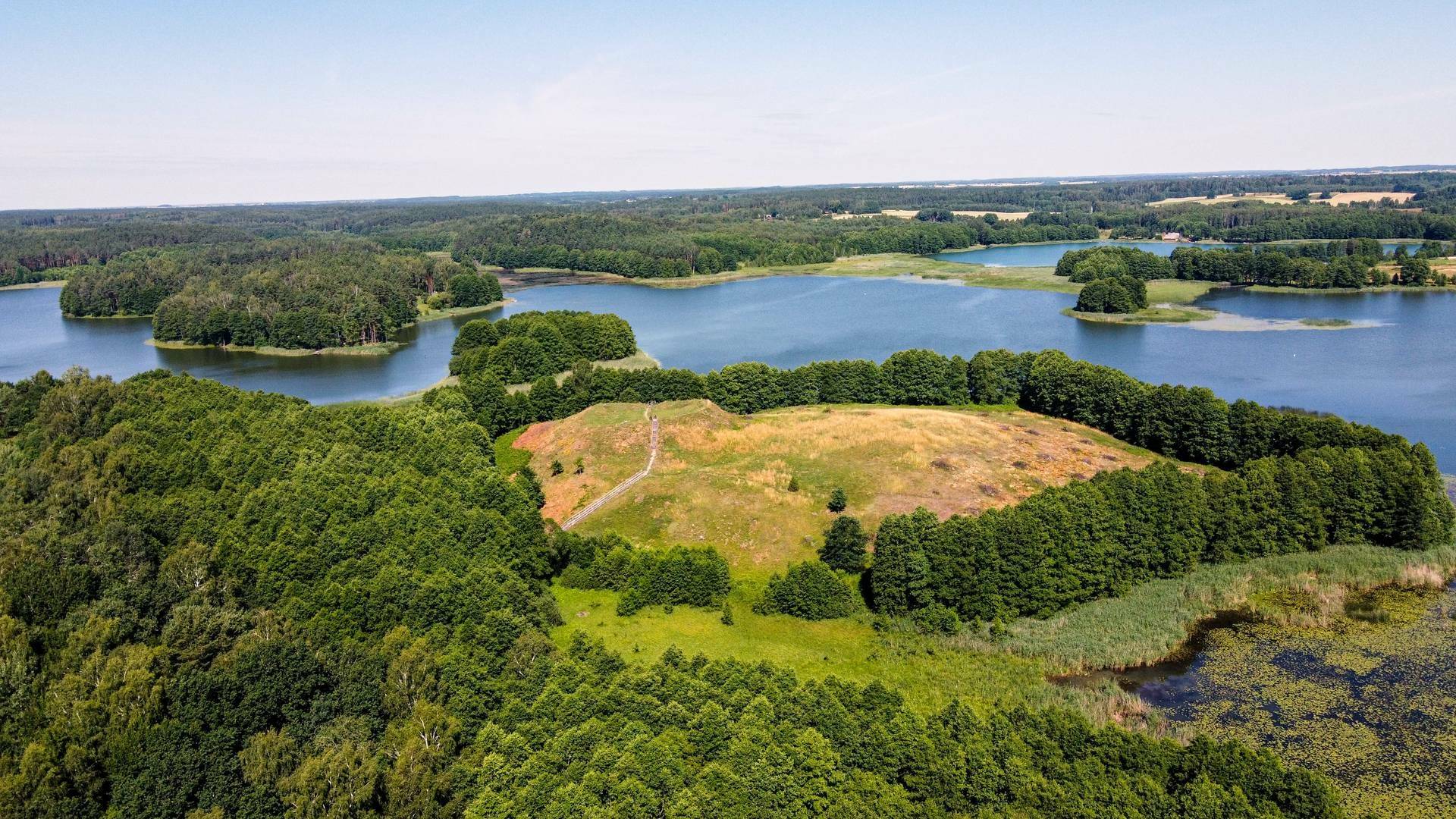
Public Institution "Lazdijai Tourism Information Center"

Mound of Paveisininkai with Settlement

Mounds

Mounds are naturally formed hills and coastal outcrops with man-made fortifications. There are more than 800 mounds in Lithuania.
The first mounds in the Baltic territories date back to the turn of the 2nd - 1st millennia BC. In the first centuries of our era, castle mounds spread throughout the territory of Lithuania.

The defensive system of the hillfort consists of two main elements: the fortified site itself - the hillfort square - and its fortifications. The mound site is the former castle courtyard. It was the site of various buildings, army gatherings and hiding places for the inhabitants of the surrounding area. The square was bounded by fortifications such as ramparts, ditches, terraces and built slopes. On top of these stood various wooden fences, barriers, towers and walls. The height and steepness of the slopes of the mound was one of the most important indicators of the inaccessibility of the castle. The natural height and steepness of the slopes of the hills or promontories were used to further strengthen the slopes. Some of the fortifications have deteriorated, so that only some of the former earth fortifications can be seen on the mounds today, and the remains of wooden fortifications can only be found during archaeological research.

Near such mounds, there were foothill settlements, ancient burial sites, and even shrines. The hillforts protected the surrounding settlements, whose inhabitants provided the castle garrison with all the necessary products. Those who died defending the castle and the settlements around it were buried in the community cemeteries of the time. The old settlements were adjacent to production sites and roads.

During the formation of the Lithuanian state and the battles with the Teutonic Knights and the Livonian Order (the beginning of the 12th and 15th centuries), hillforts with the most powerful fortifications - ramparts up to 5 metres high and ditches up to 3 metres deep - were built. On their sites stood sturdy wooden castles. When the main wooden castle on the hillfort was reinforced, the more powerful fortifications were not able to be accommodated on the hillfort itself, so some of them had to be moved outside the old fortifications. This led to the creation of forposts and outposts. A 'forpost' is a defensive enclosure - like an extension of the castle itself - that is usually more fortified by its visible fortifications than the castle site. A outpost is a large foothill settlement that existed next to the hillfort, surrounded by fortifications.

After the battles of Žalgiris (1410) and Pabaiskas (1435), the wooden castles in Lithuania lost their significance and the castle mounds were abandoned. The natural terrain lost its defensive function as stone castles were built.

Mounds are an integral part of the Lithuanian landscape. The State protects the entire hill of the castle mound, together with its slopes and the settlement at its foot. The finds found there are of great importance for the knowledge of the 2500 years of prehistory of the region.

The Paveisininkai hillfort was built using the south-western edge of a hill on the south shore of Lake Veisiejis. The top of the hill is an oval, elongated in the east-west direction, 30x24 m in size (the former castle courtyard), surrounded by a 1-3 m high, 8-16 m wide defensive rampart. In the northern part of the defensive wall there is a hollow 1-1,5 m deep - the site of the old entrance. To the east, the outer 4-5 m high slope of the rampart descends to a 7 m wide terrace, behind which a 9 m wide, 1,2 m deep ditch has been dug. On the west side, 5 m below the embankment, there is a 4 m wide terrace and 4 m below that a second terrace 10 m long and 15 m wide. There was a settlement of 1,5 ha at the eastern-north-eastern foot of the mound.


In 1954, the mound was explored by an archaeological expedition of the Lithuanian Institute of Archaeology led by Dr. P. Kulikauskas. Traces of a settlement were found in the north-eastern and eastern foot of the mound. In 1962, the mound was explored by Dr. V. Daugudis, an archaeologist of the Lithuanian Institute of History. He found shards of moulded pots, with a rough, striped, smooth surface and clay plaster at the foot. In the same year, extensive archaeological investigations of the mound and the settlement were carried out under the direction of Dr P. Kulikauskas.

An area of 240 m2 was excavated in the north-eastern part of the mound site. A transverse cut was made across the entire northern slope up to the foot of the mound at the highest point of the defensive rampart, and a second cut was made in the south-eastern part. The rampart was found to have been built twice. The first rampart was 1,6 m high and paved with stones at the top. It had existed for a long time, as it is separated from the next phase of construction by a rather distinct layer of darker earth. Two surviving defensive ditches were found on the outer slope of the rampart. The raised rampart is reinforced externally with clay and stones. A wooden post-and-beam defensive wall was built on top.
A 1 m thick cultural layer with rough pottery was found on the mound site. Before the construction of the mound, there was a burial ground on the site in the 1st millennium BC. During the excavations, 27 graves of the burnt dead were discovered.

Reviews

Comment