
The length of the trail is 3.2 km
The place is the north-western coast of Lake Dusia (Lazdija district)
The starting and ending point is a resting place, 1.5 km south of the Prelomčiške mound, location on the map .
WGS coordinates - 54.304194, 23.659444.
The trail is circular.
It will take you 1 hour. 20 minutes
Surface - mowed path through the meadow, asphalted road.
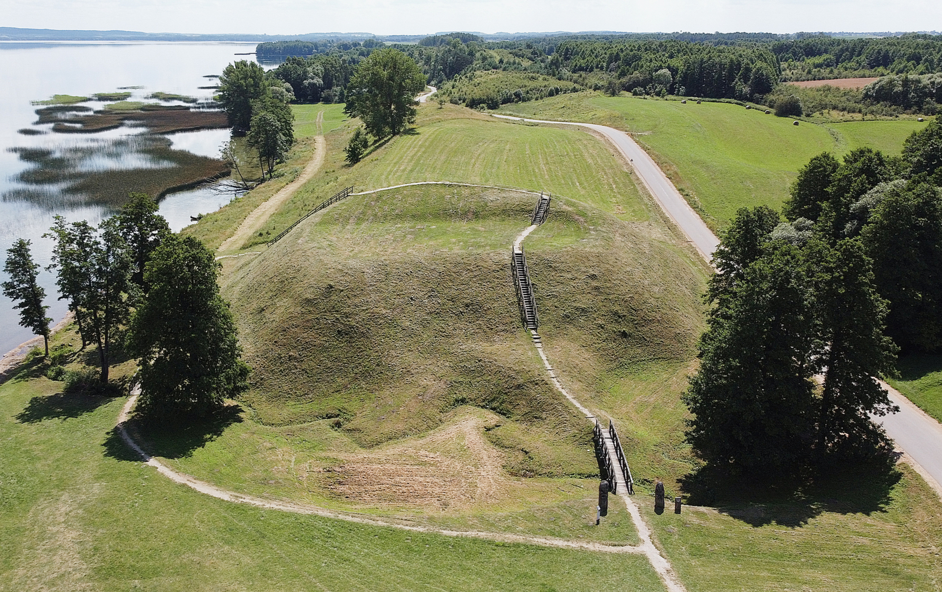
Prelomciškė hill meadows are dry steppe meadows, small areas of which have survived in Lithuania and even in the European Community. The plants of these meadows are adapted to an environment with low humidity and relatively high temperature. Thin hair is pleasing to the eye on the second and third days of May. The hills look most beautiful at the end of June and in July, when sedges, sedges, sedges, thyme, alfalfa, and mountain brambles bloom. Then the caps and slopes of the ridges sparkle with the various colors of the grass flowers.
Spectacular panoramas of Lake Dusias open here. The highest point of the trail rises as much as 25 meters above the water level of Lake Dusia. In the northern part of the path stands the hill of Prelomčiške.
It is most convenient to park your car in the parking lot on the southern part of the trail.
Information from the website of the Metėliai Regional Park https://saugoma.lt/lt/objektai/objektai-pesciuju-pazintinis-takas-prelomciskes-kalvomis
VšĮ Lazdijai tourism information center
Kaunas str. 6A, LT-67128 Lazdijai
www.lazdijai-turizmas.lt
email p.: [email protected]
Tel. +370 318 51881

Reviews